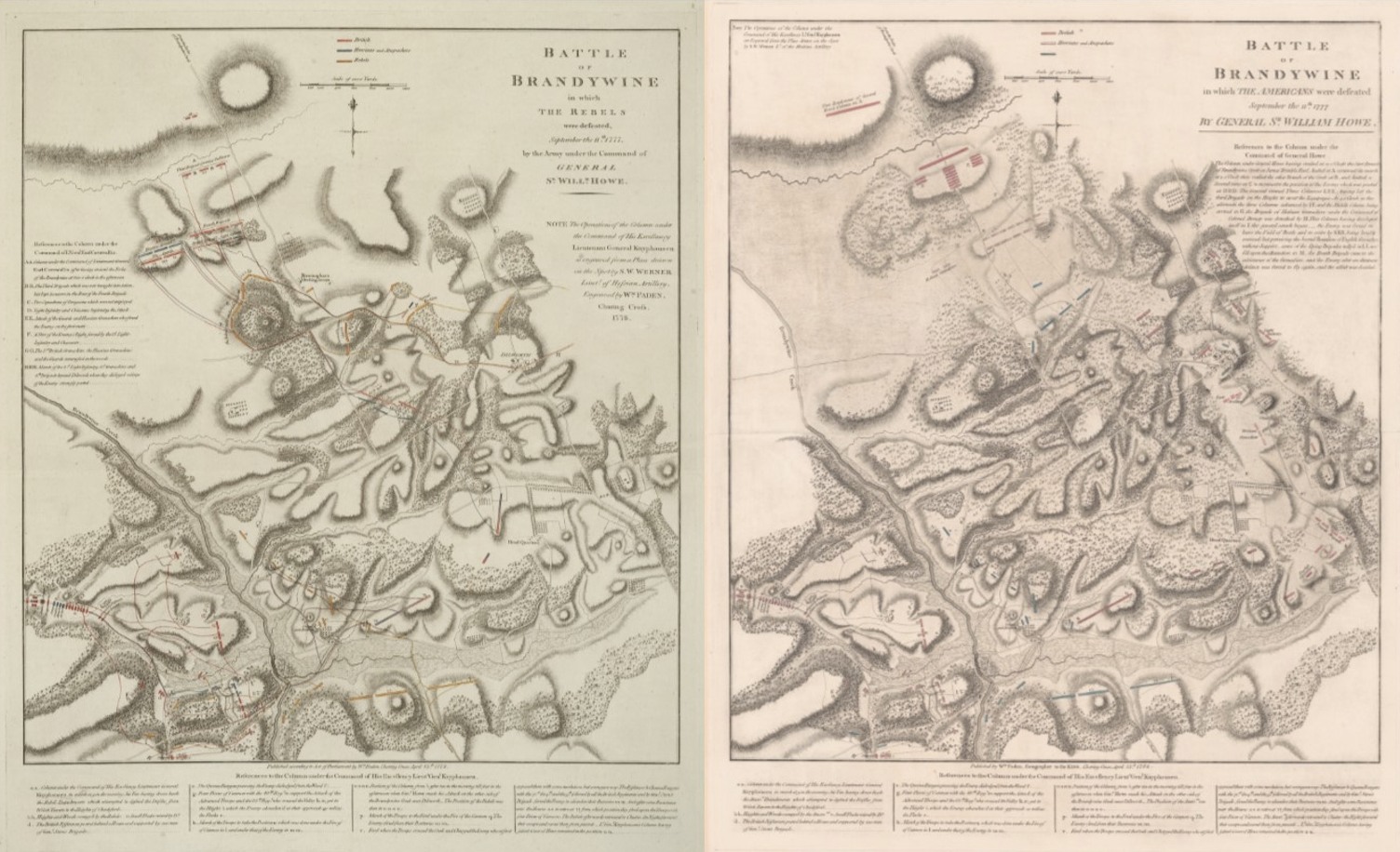
British cartographer William Faden is well known for his maps depicting major battles of the Revolutionary War. Unusually, he produced two maps of the Battle of Brandywine, one in 1778 and the other in 1784. Each map shows troop movements and positions along with other aspects of the overall battlefield landscape, but each conveys significantly different information.
Join us this Sunday night at 7p.m. on our Facebook page as we chat with Andrew Outten, historical programs manager for the American Revolution Institute of the Society of the Cincinnati. Andrew will discuss the Battle of Brandywine, key differences between the two maps, and recent discoveries pertaining to those differences. Should be a great night sharing new research so grab a drink and join us for our January 8th Rev War Revelry!

Please use some other media, such as Zoom or You Tube in addition (or instead of) Facebook. I find that FB is very quick to disable accounts and very hard to work with. I have missed several presentations because of FB’s constraints.
LikeLike
Hey Clinton,
All our Rev War Revelries are also on our YouTube page as well.
LikeLike